 vesseltracker.com
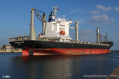
Vessel FERDINANDA S IMO: 9445019, MMSI: 255805603 Container Ship
UTC, 38.68610, -9.21595, course: 80, speed: 10.2
UTC, 38.69784, -9.17446, course: 78, speed: 0
2026-01-31 14:16:55 UTC, 38.69783, -9.17449, course: 77, speed: 0
Live AIS position:
UTC. Near Memória),
updated 2026-01-31 14:16:55 UTC.
Find the position of the vessel FERDINANDA S on the map. The latter are known coordinates and path.
marine traffic ship tracker show on live map
The current position of vessel FERDINANDA S is 38.69783 lat / -9.17449 lng. Updated: 2026-01-31 14:16:55 UTCCurrently sailing under the flag of Portugal (MAR)
FERDINANDA S built in 2008 year
Deadweight:
21464 tDetails:
Last coordinates of the vessel:
UTC, 38.71131, -9.70820, course: 176, speed: 14.4UTC, 38.68610, -9.21595, course: 80, speed: 10.2
UTC, 38.69784, -9.17446, course: 78, speed: 0
2026-01-31 14:16:55 UTC, 38.69783, -9.17449, course: 77, speed: 0